Cypress Run community ponds · August condition record
- Site
- Cypress Run, Sarasota County, FL · ponds 2 and 3
- Flight date
- 14 August 2026
- Compared with
- 12 May 2026 (quarter 2)
- Schedule
- Quarterly stormwater pond record
Site details and dates above are illustrative. No May photos are shown; the comparison below is fictional.
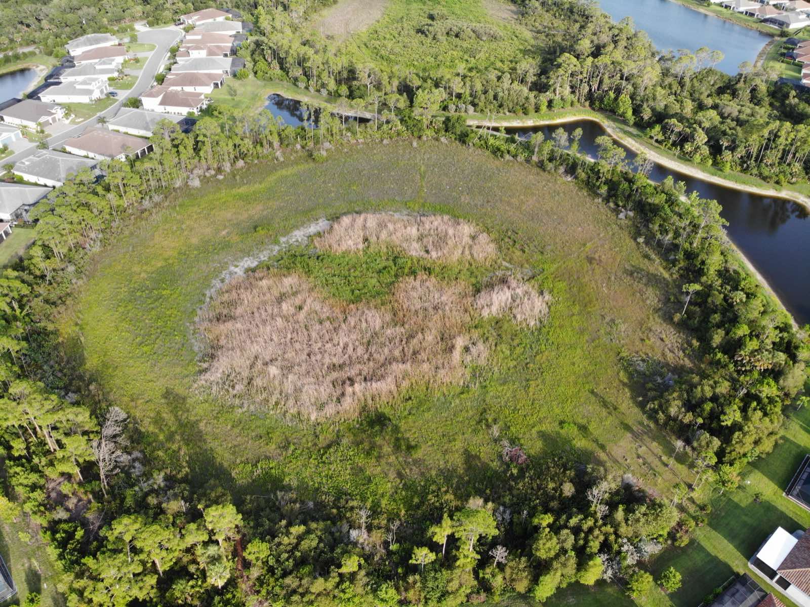
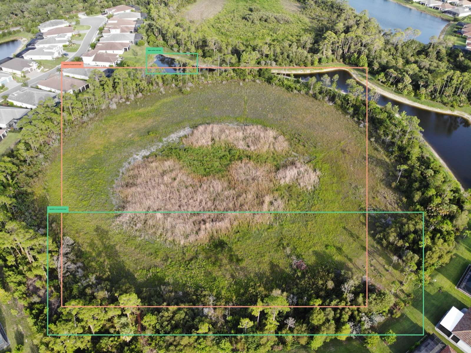
In this illustrative comparison, no visible change is identified for Pond 2. Pond 3 is flagged for follow-up: dense vegetation is visible across most of the pond basin, with little open water visible.
Illustrative comparison: May to August
| Area | May 12 | Aug 14 | Note |
|---|---|---|---|
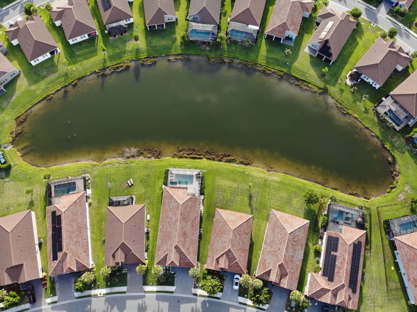
| Pond 2, open water | Open water visible | Open water visible | No visible change identified in this example |
| Pond 2, south bank | Mowed to the edge | Mowed to the edge | No visible change identified in this example |
| Pond 3, main basin | Open water with vegetation along the shallow shoreline | Dense vegetation visible across most of the pond basin | Little to no open water visible |
| Pond 3, northeast outlet structure | Structure visible | Obscured by growth | Condition cannot be determined from these photos |
Pond 3 · main basin · viewpoint 1
What stood out
- Pond 3, main basin. Dense green and dried-brown vegetation is visible across most of the pond basin. Little to no open water is visible. The fictional May entry describes open water with vegetation along the shallow shoreline.
- Pond 3, northeast outlet structure. In this example, a structure recorded as visible in May is obscured by growth in August. Its condition cannot be determined from these photos.
- Pond 2. Open water and a mowed bank are visible. No visible change is identified in the illustrative comparison.
Suggested follow-up
Share the Pond 3 photos with your pond maintenance contractor. Ask them to check the vegetation and the outlet structure obscured in the image, and advise whether an engineer’s assessment is needed. The aerial photos alone do not establish whether water flow is affected or maintenance is required.
Pond 2 · viewpoint 1 · open water visible
Scope
A delivered report records what was visible from the approved viewpoints at the stated flight time, with every flagged item reviewed by a person before delivery. This sample uses fictional dates and comparison history to demonstrate that format. Aerial photos do not establish water quality, depth, permit compliance or structural condition. Those decisions stay with your licensed professional.